Scan to BIM converts laser scan data of an existing building into a usable Revit model. Buying it well comes down to four things almost nobody discusses openly: a scope of work that states exactly what is modelled, a written deviation tolerance, an agreed level of development, and a quality process that checks the model back against the scan. Get those right and the deliverable is dependable. Skip them and you receive a model that looks correct, cost what you expected, and cannot be relied on for the thing you bought it for.
- What scan to BIM delivers
- The terminology untangled
- It is not automatic
- Defining the scope of work
- Tolerance: the number that must be agreed
- LOD and what each level costs you
- The workflow from a buyer’s perspective
- Quality control: what actually gets checked
- Who does the scanning?
- Gulf site conditions
- How scan to BIM is priced
- Twelve questions to ask a provider
- Seven ways it goes wrong
- Frequently asked questions
What Scan to BIM Actually Delivers
Scan to BIM is the end-to-end workflow that produces an accurate as-built BIM model of an existing building from 3D laser scanning. Inside it sits the stage that consumes most of the effort: point cloud to BIM, where processed scan data is converted into an intelligent model, normally in Autodesk Revit.
The deliverable is not the scan. It is a modelled representation of what exists — walls, structure, services, equipment — that a design team can work against, a contractor can price from, and an operator can use.
This guide covers how to specify, buy and judge that service. For the underlying technology — how LiDAR measures distance, what a point cloud contains, the types of scanning system and their accuracy limits — see our guide to LiDAR and laser scanning in construction.
The Terminology Untangled
Four terms describe overlapping parts of the same workflow, and different providers emphasise different ones. That is a marketing artefact, not a technical distinction.
| Term | What it usually refers to |
|---|---|
| Scan to BIM | The umbrella term: field scanning, registration, processing, modelling, quality control and delivery |
| Point cloud to BIM | The modelling stage specifically — starting from a registered cloud rather than from site |
| Point cloud to Revit | The same, with the authoring platform named |
| Laser scan to BIM | Interchangeable with scan to BIM; emphasises the capture method |
| As-built BIM modelling | The outcome rather than the method — may or may not involve scanning |
It Is Not Automatic
A persistent misconception is that scan to BIM produces a model automatically — that software ingests a point cloud and outputs a Revit file.
It does not. Modern software has improved feature detection considerably, and emerging tools can extract walls, ceilings and obvious geometry automatically. But for production-grade deliverables the bulk of the modelling is still done by trained technicians tracing off the point cloud, deciding what each cluster of points represents and modelling it as the right element with the right properties.
This has three consequences worth understanding before you buy:
- Cost scales with modelling effort, not with cloud size. A large simple warehouse can cost less to model than a small congested plant room.
- Quality varies with the technician. The same point cloud handed to two providers produces different models, because interpretation is a judgement.
- “AI-powered” claims deserve a specific question. Ask which parts of the process are automated and what proportion of the model is machine-generated versus traced. The honest answer on most projects today is that automation assists and humans model.
Need an as-built model you can actually design against?
AMC Engineer converts point cloud data into coordinated LOD 300–500 BIM models across Architecture, Structure, MEP, Electrical, Infrastructure and Landscape — with a free LOD 200 sample from your own data in 24 hours, so you can judge the output before committing.
Defining the Scope of Work
Before any modelling begins, the scope of work must be defined and communicated. A vague scope is the root cause of most disputes on these projects, because the provider models what they assumed and the client expected something else — and both positions are defensible against a scope that never said.
A scope that prevents that argument states:
- Trades included and excluded. Architecture, structure, mechanical, electrical, plumbing, fire protection — each named as in or out. “MEP” is not specific enough; fire protection is frequently assumed in by the client and out by the provider.
- Areas included and excluded, by level, zone or room. Plant rooms, risers, roof areas and basements should be named explicitly because they are the expensive parts.
- Element types modelled. Which components are modelled as objects, which are represented generically, and which are omitted. Small-bore pipe, conduit, hangers and supports are the usual boundary.
- Concealed areas. Whether above-ceiling and in-riser services are in scope, and if so how access will be provided for scanning.
- The required LOD, per discipline if it differs.
- The deviation tolerance, covered in the next section.
- Deliverable formats and software versions.
On larger engagements this is formalised as a Scan to BIM Execution Plan — sometimes written BEP or BXP — which does for a scan project what a BIM Execution Plan does for a design project. Our guide to the BIM Execution Plan covers the general structure.
Tolerance: The Number That Must Be Agreed
You will see “99% accuracy” on a lot of scan to BIM service pages. It is worth being blunt: as a specification, that number means nothing. Ninety-nine percent of what, measured how, against what reference?
Accuracy in this workflow has three distinct layers, and providers quoting a single headline figure are usually collapsing them.
| Layer | What it measures | Who controls it |
|---|---|---|
| Instrument accuracy | How precisely a single point is measured | The scanner specification and survey conditions |
| Registration accuracy | How well individual scans align into one cloud | The survey team — scan overlap, targets, control |
| Model deviation | How closely modelled elements match the cloud | The modelling team and the agreed tolerance |
The third layer is the one you are actually buying, and it is a project agreement rather than a technical constant. The reason is that real buildings are not orthogonal: walls lean, slabs deflect, columns are out of plumb, and services sag. A BIM model is made of idealised elements. Somewhere between the cloud and the model, a technician decides how much of that irregularity to represent and how much to straighten.
What to specify in writing:
- The maximum permitted deviation of modelled elements from the point cloud.
- How out-of-plumb and out-of-level conditions are handled — modelled as found, or idealised with the deviation noted.
- Whether the tolerance differs by element type. It usually should: structural elements and clash-critical services warrant tighter tolerance than partitions.
- How achieved deviation will be reported at delivery.
LOD and What Each Level Costs You
Defining scope and LOD together is what prevents over-modelling and under-modelling — the two ways a scan to BIM project wastes money in opposite directions.
| Level | What you get | Suitable for | Relative effort |
|---|---|---|---|
| LOD 200 | Generic elements with approximate size and position | Space planning, feasibility, early massing of a retrofit | Lowest |
| LOD 300 | Accurate geometry with correct size, position and identified element types | Design development against existing conditions; coordination of new work | Moderate |
| LOD 350 | Adds interfaces, supports, connections and access zones | Retrofit coordination where new services thread through existing ones | High |
| LOD 500 | Field-verified with asset data attached | Facility management handover, asset registers, digital twin foundation | Highest — data capture on top of modelling |
The mistake that costs most is buying LOD 300 across the whole building when only the plant rooms and service routes needed it. Specify by area and discipline: LOD 300 for the MEP in the plant room, LOD 200 for the office floors, and nothing at all for areas you will not touch. Our guide to BIM levels of development covers what each level includes and excludes.
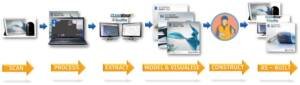
The Workflow From a Buyer’s Perspective
| Stage | What happens | What you should see or approve |
|---|---|---|
| 1. Scope definition | Trades, areas, elements, LOD and tolerance agreed | A written scope you have read line by line |
| 2. Survey planning | Scan positions, targets, access and permits planned | Access arrangements and any operational disruption |
| 3. Capture | Scans executed with overlap and coverage | Confirmation that scoped areas were reached |
| 4. Registration | Scans aligned into one cloud | A registration report with achieved accuracy |
| 5. Processing | Noise, moving objects and reflections removed; cloud reduced | The processed cloud, if you want it as a deliverable |
| 6. Georeferencing | Cloud placed in the project coordinate system | Confirmation it aligns with your existing models |
| 7. Modelling | Elements built from the cloud to the agreed LOD | A pilot area first — before the whole building |
| 8. QC and delivery | Model checked against cloud; deviation reported | The deviation report and the final model |
Quality Control: What Actually Gets Checked
Every provider claims quality. The ones with a real process can describe it. Ask for these specifics.
Model against cloud
The model is compared systematically against the original point cloud to identify discrepancies — geometry gaps, elements modelled in the wrong position, and areas where the cloud was ambiguous and the modeller guessed. This is the core check, and it should be documented rather than eyeballed.
Deviation reporting
A report showing achieved deviation against the agreed tolerance, ideally as a visual heat map rather than a single number. This is what converts “99% accurate” into something you can verify.
Completeness against scope
Every trade and area named in the scope is present in the model, and anything omitted is listed with a reason — usually occlusion or lack of access, both of which are legitimate and both of which you need to know about.
Independent checker
The person checking is not the person who modelled. This is a basic control and its absence is a meaningful signal.
Recorded checklist
A completed checklist per delivery, not an informal review. If a provider cannot show you a blank one, there probably is not one.
Want to judge the output before you commit?
We produce a free LOD 200 sample from your own drawings or scan data within 24 hours — so you can assess interpretation, conventions and quality against your own standards rather than a curated portfolio.
Who Does the Scanning?
A question that changes the commercial picture significantly, and one that most service pages leave deliberately vague.
Broadly there are three arrangements:
| Arrangement | How it works | Consider |
|---|---|---|
| Provider scans and models | One party takes responsibility end to end | Single point of accountability; requires the provider to have local presence and equipment |
| You engage a surveyor; provider models | A local survey firm captures; the BIM provider models from the delivered cloud | Most common on Gulf projects. Requires the survey brief to be written against the modelling scope, not independently |
| You already have a cloud | Modelling only | Cheapest, but the cloud may not cover what the model needs — check before scoping |
The second arrangement is where most problems originate, and the cause is always the same: the survey was briefed without reference to the modelling scope. A surveyor asked to “scan the building” will produce excellent coverage of accessible spaces and no data above ceilings, because nobody told them the model needed the services. Discovering that after the survey team demobilises means a second mobilisation.
Gulf Site Conditions
Scanning in Saudi Arabia and the UAE carries practical constraints that affect both the survey and the price, and none of the internationally written service pages mention them.
- Dust. Airborne dust scatters the laser and settles on optics, producing noisier data and requiring routine instrument cleaning. It also means scanning immediately after a dusty period gives poorer returns.
- Heat. Equipment has operating temperature limits, and air shimmer over hot surfaces degrades returns at longer ranges. Both affect external scanning in summer.
- Summer outdoor work restrictions. Both countries restrict outdoor work during specified midday hours in the peak summer months, which compresses the usable working day for external capture and extends survey duration.
- Reflective architecture. Glass curtain walling, polished stone and bright metal cladding are common regionally and return unreliable data. Heavily glazed facades often need supplementary measurement, and that should be priced rather than discovered.
- Occupied and operating buildings. Scanning live retail, hospitality, healthcare or industrial environments means working around operations, often at night or during shutdowns, with access approvals arranged well in advance. Night working affects the rate.
- Access approvals. On master-planned developments, free zones and government assets, permission to survey can take longer than the survey.
How Scan to BIM Is Priced
Almost no provider publishes pricing methodology, which makes comparing quotes harder than it should be. These are the models you will encounter.
| Model | How it works | Best when | Watch for |
|---|---|---|---|
| Per square metre | Rate per area, usually varying by LOD and discipline | Regular, repetitive buildings | A flat rate across a building with plant rooms and office floors overcharges one and undercharges the other |
| Per discipline | Separate rates for architecture, structure and MEP | Where you need only some disciplines | Confirm what “MEP” includes — fire protection is often separate |
| Hourly / day rate | Time-based | Undefined or exploratory scope | No cost certainty; agree a cap |
| Fixed price | Lump sum against a defined scope | Clear scope, clear tolerance, clear LOD | Only as good as the scope; agree how variations are priced |
| Survey separate from modelling | Two contracts or two line items | Where a local surveyor is used | Interface risk sits with you unless someone is made responsible for it |
What actually drives the price — useful when a quote looks high or low:
- LOD — the largest single factor, and the one most worth specifying by area.
- Congestion — a dense plant room costs far more per square metre than an open floor.
- Disciplines included, particularly whether MEP and fire protection are in.
- Tolerance — tighter tolerance means more time verifying and adjusting.
- Cloud quality — a poorly registered or sparse cloud increases modelling time and ambiguity.
- Access and survey conditions — night working, shutdowns and multiple mobilisations.
- Deliverable formats — native model, IFC, drawings, asset data. Each adds work.
Twelve Questions to Ask a Provider
- Does your price include field scanning, or do I provide the point cloud?
- What deviation tolerance are you quoting against, and how is it measured?
- What LOD is included, and does it vary by discipline or area?
- Which trades and areas are explicitly excluded?
- How do you handle concealed services above ceilings and in risers?
- Will you model a pilot area first for approval before proceeding?
- Who checks the work, and can I see a blank QC checklist?
- What does the deviation report look like at delivery?
- What proportion of the modelling is automated versus traced by a technician?
- What formats and software versions are delivered, and who owns the model?
- How are variations priced if the scope changes mid-project?
- Can you produce a sample from my own data before I commit?
Seven Ways Scan to BIM Goes Wrong
| Failure | What it causes | The fix |
|---|---|---|
| Survey briefed without the modelling scope | No data above ceilings; a second mobilisation | Write the survey brief backwards from what the model must contain |
| Tolerance never agreed | Dispute over whether a leaning wall should have been modelled leaning | Written deviation tolerance, varied by element type where appropriate |
| Single LOD across the whole building | Paying plant-room rates for office floors, or vice versa | Specify LOD by area and discipline |
| No pilot area | A modelling convention you disagree with, applied to the whole building | Approve one representative area before releasing the rest |
| Cloud not georeferenced to project coordinates | The model will not align with the design models it exists to be checked against | Confirm the coordinate system before modelling starts |
| Occluded areas modelled by assumption | A model that looks authoritative and is partly invented | Require omissions and assumptions to be listed, not filled in silently |
| Accepting a headline accuracy claim | No basis to reject a deliverable that does not meet your actual need | Specify the layer of accuracy you mean and how it will be reported |
Frequently Asked Questions
What is scan to BIM?
Scan to BIM is the end-to-end workflow that produces an accurate as-built BIM model of an existing building from 3D laser scanning. Within it, point cloud to BIM is the stage where processed scan data is converted into an intelligent model, normally in Autodesk Revit. The deliverable is the model, not the scan.
Is scan to BIM automatic?
No. Software has improved feature detection and emerging tools can extract walls, ceilings and obvious geometry automatically, but for production-grade deliverables the bulk of the modelling is still done by trained technicians tracing off the point cloud. That is why cost scales with modelling effort rather than cloud size, and why the same cloud handed to two providers produces different models.
What is the difference between scan to BIM and point cloud to BIM?
Scan to BIM is the umbrella term covering field scanning, registration, processing, modelling, quality control and delivery. Point cloud to BIM refers specifically to the modelling stage, starting from an already registered cloud. The distinction matters commercially, because it determines whether a quote includes the survey.
What does “99% accuracy” mean in scan to BIM?
As a specification, very little. Accuracy has three distinct layers: instrument accuracy for a single measured point, registration accuracy for how scans align into one cloud, and model deviation for how closely modelled elements match that cloud. The third is what you are buying, and it is a project agreement rather than a technical constant, because real buildings are not orthogonal and someone must decide how much irregularity to represent.
What tolerance should be specified?
It depends on the scanner, the survey method, the site conditions and above all what the model will be used for — a model for space planning and a model for prefabrication need very different tolerances at very different costs. Specify the maximum permitted deviation from the cloud, how out-of-plumb conditions are handled, whether tolerance varies by element type, and how achieved deviation will be reported.
What LOD should I ask for?
LOD 200 for space planning and feasibility, LOD 300 for design development against existing conditions, LOD 350 for retrofit coordination where new services thread through existing ones, and LOD 500 for facility management handover with asset data. The most common costly mistake is specifying one level across the whole building when only the plant rooms and service routes needed the higher one.
Should the provider do the scanning as well?
It depends on local presence and equipment. Three arrangements exist: the provider scans and models end to end, you engage a local surveyor and the provider models from the delivered cloud, or you already have a cloud. The second is most common on Gulf projects and is where most problems originate — because the survey is often briefed without reference to what the model needs to contain.
How do I stop the survey missing what the model needs?
Write the survey brief backwards from the modelling scope. Decide what the model must contain, then specify the coverage, access and scan positions required to capture it. If ceiling tiles need lifting or a plant room needs a shutdown window, that belongs in the survey brief rather than being discovered during modelling, when a second mobilisation is the only remedy.
How is scan to BIM priced?
Commonly per square metre varying by LOD and discipline, per discipline, hourly, or as a fixed price against a defined scope. What drives the price is LOD, congestion, which disciplines are included, the tolerance required, the quality of the point cloud, access and survey conditions, and the deliverable formats. A flat rate across a building containing both plant rooms and open floors will misprice one of them.
How do Gulf site conditions affect a scan?
Dust scatters the laser and settles on optics, producing noisier data. Heat affects equipment operating limits and causes air shimmer at longer ranges. Summer outdoor work restrictions in both Saudi Arabia and the UAE compress the usable working day for external capture. Reflective glass and polished stone facades, common regionally, return unreliable data and may need supplementary measurement. Occupied buildings often require night working or shutdown windows.
What should be delivered at the end?
The model in the agreed formats and software versions, a registration report showing achieved survey accuracy, a deviation report showing how closely the model matches the cloud, a completeness statement listing anything omitted and why, and the processed point cloud if you have specified it. Anything omitted should be listed with a reason rather than quietly filled in.
How do I evaluate a provider before committing?
Ask for a sample produced from your own data to your own standards, since portfolios are curated and samples are not. Alongside it, ask whether scanning is included, what tolerance is being quoted against, what LOD and exclusions apply, how concealed services are handled, whether a pilot area will be modelled first, who checks the work, what the deviation report looks like, and who owns the model at the end.
Conclusion
Scan to BIM is straightforward to buy badly and not much harder to buy well. The difference is four documents rather than four technologies: a scope that names what is in and out, a written tolerance, an LOD specified by area rather than blanket, and a QC process with an independent checker and a deviation report.
Two habits protect you more than any of them. Write the survey brief backwards from what the model must contain, so the capture covers what the modelling needs. And approve one representative area before releasing the whole building, so a modelling convention you disagree with costs hours instead of the project. Everything else — software, scanner brand, headline accuracy percentages — matters far less than these.
Let’s start with a sample from your own data.
AMC Engineer delivers scan to BIM modelling, federated coordination and construction documentation for contractors, consultants and asset owners across Saudi Arabia and the UAE — from LOD 200 space models to verified LOD 500 as-built deliverables.